Uruguay's commercial relationship with Brazil and Argentina, the concentration of its population in the capital, Montevideo, and a low-use railway network (currently being upgraded) mean that intra-regional trade flows mainly through the road system. For this reason, there is a road network connecting Montevideo with the region's main cities. Three bridges over the Uruguay River link the country to Argentina at the cities of Salto, Paysandú, and Fray Bentos, while access to Brazil is via land borders at the cities of Bella Unión, Artigas, Rivera, Aceguá, Río Branco, and Chuy.
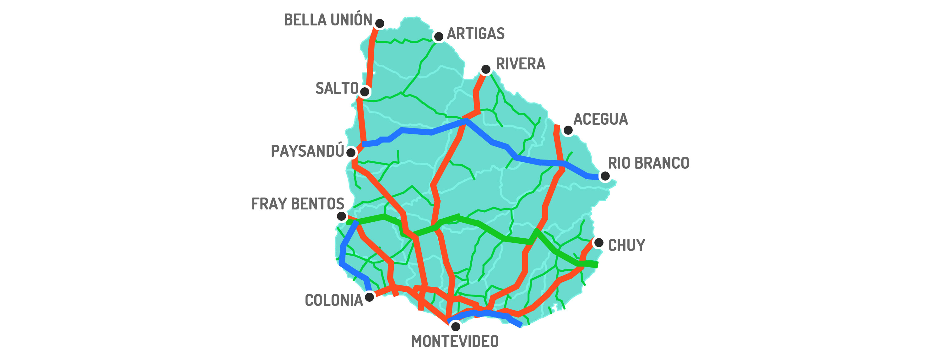
Connectivity of Uruguay's main highways with Brazil and Argentina.
International Corridor – Primary Route – Secondary Route – Border Crossings
Uruguay has the highest degree of road connectivity and the densest road network of all Latin American countries. It is also the third-ranked country in South America in terms of road quality (The Global Competitiveness Report 2016, World Economic Forum).
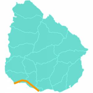
Brigadier General Manuel Oribe: This is one of Uruguay's national routes. It crosses the country from west to east, running through the departments of Montevideo, San José, and Colonia, and connects the cities of Montevideo and Colonia del Sacramento. This highway consists of a dual carriageway from the city of Montevideo to the junction with Route 22 in the department of Colonia, and a single-carriageway section between Route 22 and the city of Colonia del Sacramento. Its total length is 177 km.
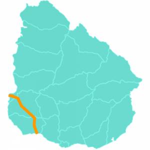
Grito de Asencio: It begins at a junction on Route 1, 50 km from Colonia del Sacramento, and heads north to the cities of Florencio Sánchez and Cardona, at the departmental border with Soriano. There, the highway turns northwest and, crossing the department of Soriano, reaches its capital, Mercedes. It crosses the Negro River and, after a 30 km stretch, reaches the city of Fray Bentos, on the banks of the Uruguay River. Eight kilometers before reaching Fray Bentos is the junction leading to the Libertador General San Martín Bridge, the crossing into Argentina over the Uruguay River.
Length: 180 kilometers.
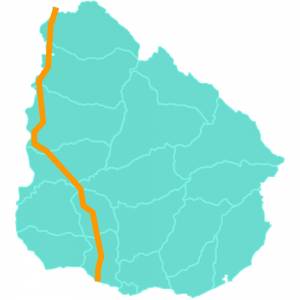
General José Gervasio Artigas: Route 3 is one of Uruguay's national routes. It runs across the country from south to north, passing through the departments of San José, Flores, Soriano, Río Negro, Paysandú, Salto, and Artigas. This highway begins at km 67 of Route 1, in the department of San José, and ends its course at the border with Brazil, on the banks of the Cuareim River, connecting with the Brazilian highway BR-472 via the Bella Unión – Barra do Quaraí International Bridge. In total, it has a length of 563 kilometers (numbered from km 67 to km 630). Length: 563 kilometers.
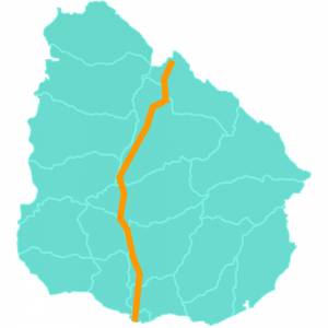
Brigadier General Fructuoso Rivera: Route 5 is one of Uruguay's national routes.
It crosses the country from south to north, connecting the cities of Montevideo and Rivera, and running through the departments of Montevideo, Canelones, Florida, Durazno, Tacuarembó, and Rivera.
It begins in the city of Montevideo as a 4-lane dual carriageway, where it branches off from Route 1 at an interchange. The route continues as a dual carriageway (4 lanes) throughout the Metropolitan Area up to the city of Canelones (approximately 45 kilometers from Montevideo) and then continues as a single carriageway, though very well maintained and signposted, crossing the country from south to north. The highway passes through several towns and cities, with its final destination being the city of Rivera.
The dual carriageway is currently being extended to Paso de los Toros (kilometer 250).
In total, it has a length of 500 kilometers (numbered from km 0 to km 500).
Length: 500 kilometers.
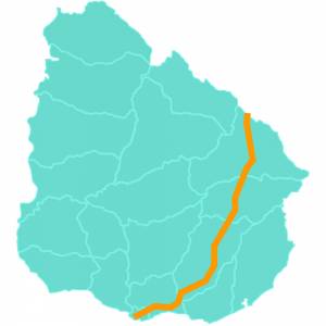
Brigadier General Juan Antonio Lavalleja: Route 8 is one of Uruguay's national routes. It runs across the country from south to north, passing through the departments of Montevideo, Canelones, Lavalleja, Treinta y Tres, and Cerro Largo.
This highway begins its course as such in the Punta de Rieles neighborhood of Montevideo—although its kilometer zero is located at Plaza Cagancha in downtown Montevideo—and ends in the town of Aceguá, in the department of Cerro Largo, at the border with Brazil, linking with highway BR-153.
Route 8 passes through three departmental capitals: Minas, Treinta y Tres, and Melo, and connects with other cities through junctions with Route 11, Route 9, and Route 26, among others.
Length: 430 kilometers.
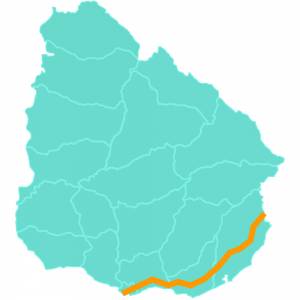
Coronel Leonardo Olivera: Route 9 is one of Uruguay's national routes. It runs across the country from west to east, passing through the departments of Canelones, Maldonado, and Rocha. Its course begins at km 65.500 of Route 8 and ends at the border crossing with Brazil located in the town of Chuy. Its total length is 276 km. At the border, it connects with Brazil's BR-471 highway.
Length: 276 kilometers.
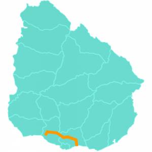
José Batlle y Ordóñez: Route 11 is one of Uruguay's national routes. With a length of 166 km, its route runs through the departments of San José and Canelones.
Length: 166 kilometers.
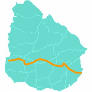
Brigadier General Venancio Flores: Route 14 is one of Uruguay's national routes. It crosses the country from west to east, running through the departments of Soriano, Flores, Durazno, Florida, Lavalleja, and Rocha. This highway has a discontinuous route of 481 km, divided into seven sections.
The first section originates in the city of Mercedes and runs from kilometer 0 to km 124.500 (numbered from west to east), crossing the departments of Soriano and Flores, up to Route 3, west of the city of Trinidad.
The second section begins in the eastern area of the city of Trinidad and ends south of the city of Durazno (junction with Route 5); this section runs from km 138.500 to km 178, numbered from west to east.
The third section originates north of the city of Durazno, at the junction with Route 5, and crosses the department of Durazno from west to east, ending its course at the junction with Route 6, in the city of Sarandí del Yí. This section runs from km 183 to km 274.
The fourth section lies between Routes 6 and 7 in the department of Florida and belongs to the departmental network, with no specific kilometer markings. It is a 46.5 km section.
The fifth section runs from the town of José Batlle y Ordóñez to Route 8, forming part of the departmental network, with a total of 64.5 km, and running through the north of the department of Lavalleja.
The sixth section originates in the city of Varela and ends in the city of Lascano (department of Rocha), but its kilometer markings are reversed (east-west direction), running from km 259 to km 299.
Finally, the seventh section begins south of the city of Lascano and, up to the Coronilla stream, has the characteristics of a departmental road; the kilometer markings resume at km 458, up to its final point at km 505, at the junction with Route 9.
The condition of the highway varies by section; it is not the same along its entire length.
Length: 480 kilometers.
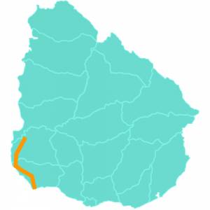
Treinta y Tres Orientales: This highway runs along the coast of the departments of Colonia and Soriano. Its route begins in the city of Colonia del Sacramento and heads northwest through the department to the city of Carmelo; from there it continues to the junction with Route 12, at the approaches to the city of Nueva Palmira. Its course continues on the north side of this city, exiting it heading north to the city of Dolores. After passing through the latter city, its final section ends in the city of Mercedes, which it enters from the south.
A large number of cargo trucks travel along this route, as agricultural activity in the region—known as "the country's granary"—has grown in recent years. All this production is destined for the port of Nueva Palmira.
Length: 185 kilometers.
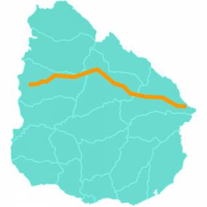
Brigadier General Leandro Gómez: Route 26 is one of Uruguay's national routes.
It crosses the country from west to east, running through the departments of Paysandú, Salto, Tacuarembó, and Cerro Largo. It is also an important connecting route within MERCOSUR.
This route begins at a junction with Route 3, on the Uruguayan coast, in the department of Paysandú, near its capital city; it passes through a few kilometers of the department of Salto, then continues through Tacuarembó, crossing right through the center of the town of Villa Ansina, passes through Caraguatá, and finally enters the department of Cerro Largo, crossing its two largest cities, Melo and Río Branco, ending in the latter.
Length: 398 kilometers.
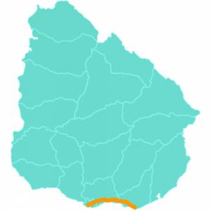
General Líber Seregni The Interbalnearia Route is one of Uruguay's national routes.
It is named as such because it runs through the beach resorts of the departments of Canelones and Maldonado, and on road maps it is identified as IB.
It is one of the most modern and best-maintained routes in the country, as well as one of the busiest—especially during the summer season and on weekends—since it provides access to beach resorts such as Atlántida, Parque del Plata, Piriápolis, and Punta del Este, all of great tourist importance both nationally and internationally.
Length: 98 kilometers.
Newsletter
Farms, ranches and investments across Uruguay.